
Unleashing the power of GPS for community-driven sustainability
By Bulisani Mlotshwa and Ntuthuko Ngwenya, MCC Zimbabwe
At the heart of the LINCZ project is the integration of scientifically backed, nature-based solutions with the knowledge of local communities. Dr. Natalia Wiederkehr's recent research visit to Zimbabwe demonstrates how technologies such as GPS (Global Positioning System) and satellite images can be tailored to support sustainable practices in smaller communities. Join us in exploring how this approach can lead to meaningful change.
From pixels to people
Satellite images come from satellites orbiting the Earth. By using cameras and sensors, the satellites capture data about the Earth's surface, which is then converted into satellite images. These images are composed of pixels, or tiny squares arranged in a grid that together form the complete image. One single satellite image can be made of millions of these pixels, creating a very detailed view of an area of land.
But satellite images alone can't tell the full story. Pixels represent landscape features that holds significance—such as a local wetland or an expansive gully threatening homes, grazing lands, and roads. Not only do these images provide valuable insights to LINCZ partners about changes in the landscape over time, but they can also help participant communities and partner staff visualize the full impact of their efforts and how project activities relate to the places they call home.
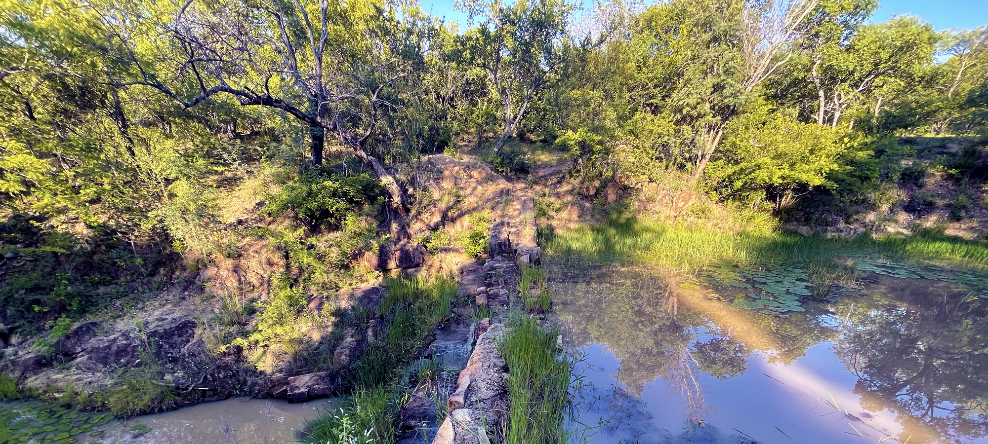
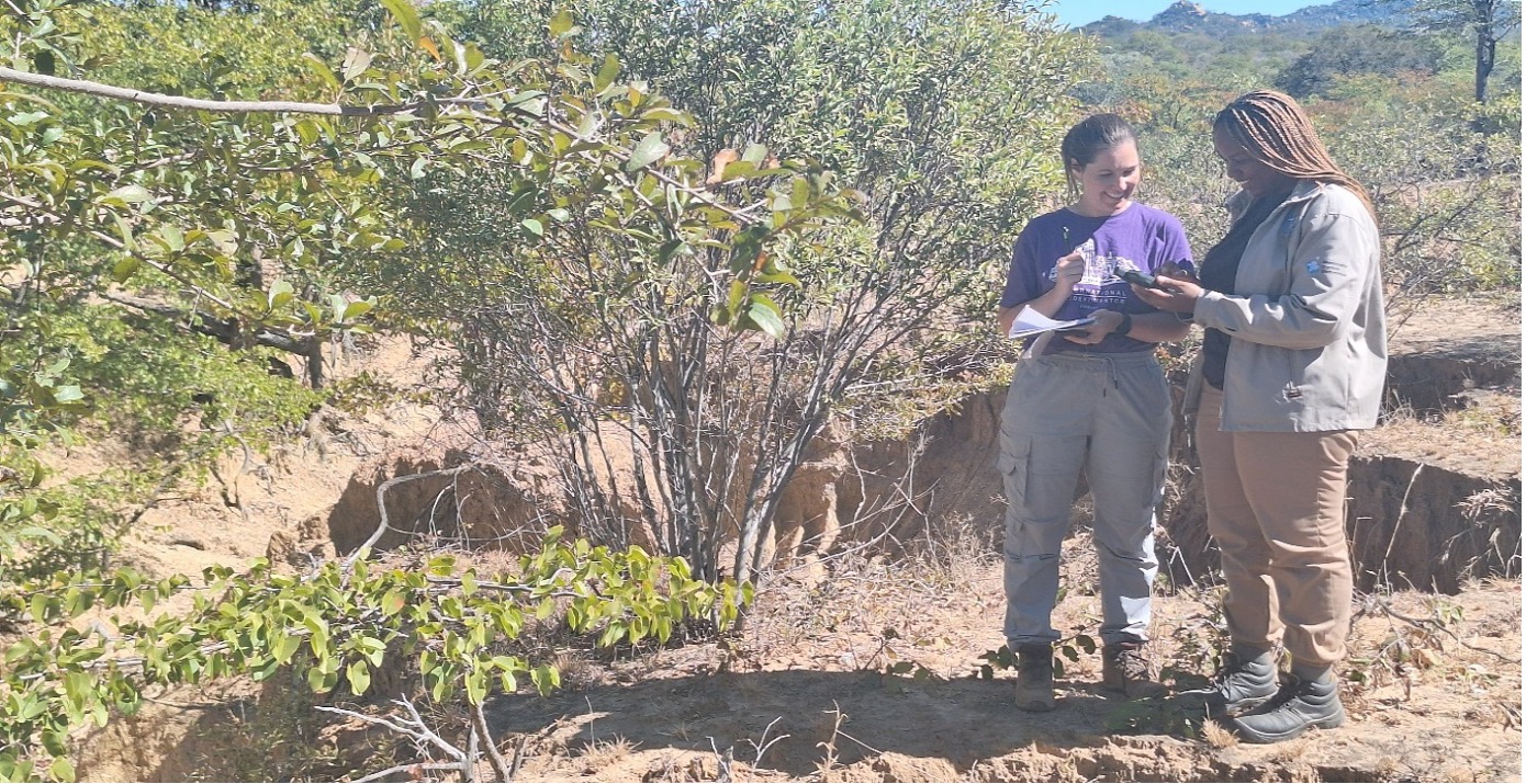
Ntuthuko Ngwenya and Dr. Natalia Wiederkehr validate a GPS point at the edge of a gully to be rehabilitated as part of the LINCZ project at eNyandeni in Gwanda district. Photo courtesy of MCC Zimbabwe, 2025.
Training the frontline
During her research visit, Natalia conducted GPS training sessions for local LINCZ partner staff from Kulima Mbobumi Training Centre (KMTC), Brethren in Christ Compassionate and Development Services (BIC-CDS), and Score Against Poverty. Participants learned about GPS technology and its various applications, taking part in hands-on workshops that utilized free smartphone GPS applications. This allowed partner staff to practice operating GPS devices and collect data points in the field, marking locations of interest such as water points and project restoration sites.
GPS coordinates can be integrated into GIS (Geographic Information System) software, making it possible to combine satellite images, coordinates, other spatial data, and computational methods to develop, interpret, and visualize spatial information to guide LINCZ activities like land restoration, farming, and water management. Through LINCZ, Extension Officers and Youth Champions are participating in GPS training to transform technology often viewed as inaccessible (such as traditional GPS units) into an empowering and accessible tool for local use.
Score Against Poverty staff members Rosemary Chibi, Nature-based Solutions Officer, Dr. Natalia Wiederkehr, and Ashton Mahachi, Community Biodiversity Lead, during practical GPS training in Mwenezi District. Photo courtesy of MCC Zimbabwe, 2025.
 BIC-CDS Agriculture Extension Officer, Immaculate Moyo validating a GPS point in one of the degraded lands in Gwanda district, whilst Dr. Natalia Wiederkehr records environmental features during practical training. Photo courtesy of MCC Zimbabwe, 2025.
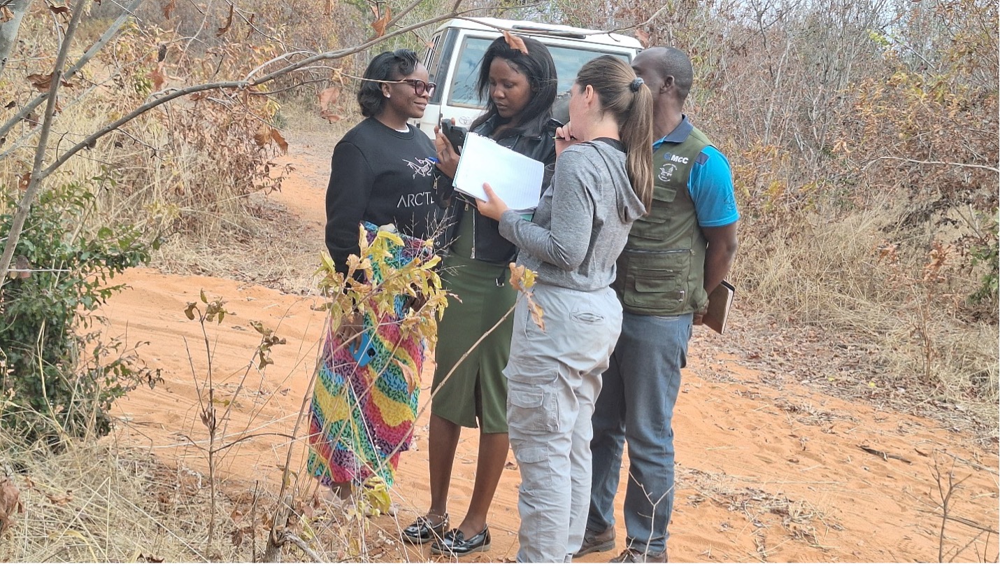
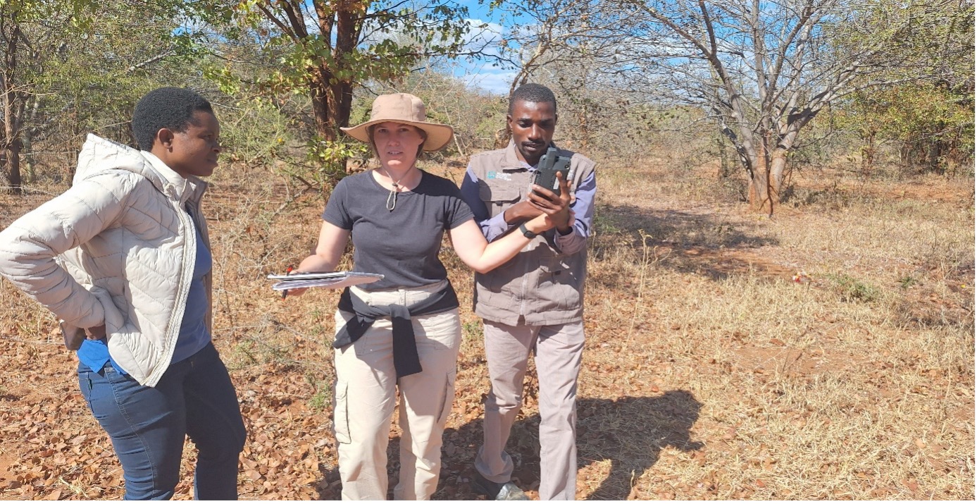
Dr. Natalia Wiederkehr in conversation with KMTC MEAL Assistant Bulindizi Munsaka, Graduate Intern Moses Tulumbe, and Crop and Livestock Officer Morgan Mudimba as they familiarize themselves with the handheld GPS device during data validation in Binga. Photo courtesy of MCC Zimbabwe, 2025.
The realities of community struggles and land use
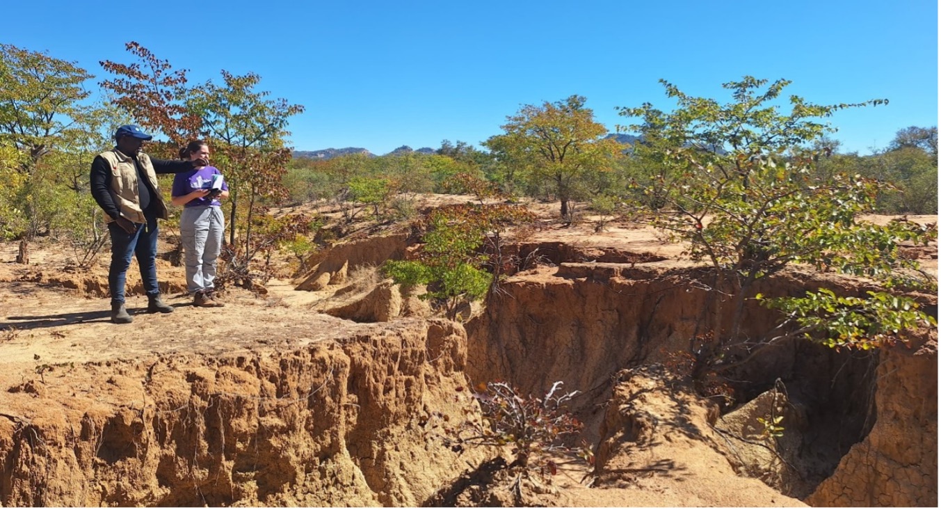
Natalia is also applying her spatial analysis and remote sensing skills in collaboration with Drs. Kirit Patel and Auther Maviza on LINCZ research examining the relationship between artisanal mining and environmental degradation in Gwanda district.
While in Gwanda, the LINCZ team met young artisanal miners who were working long hours in difficult conditions, often without protective gear or access to food. The challenges of land use and environmental degradation are deeply intertwined with socio-economic factors, which can worsen climate-related issues, such as the formation of gullies. This reinforces the need for effective, sustainable solutions that address both environmental concerns and the realities of poverty that compel individuals to engage in these activities out of necessity.
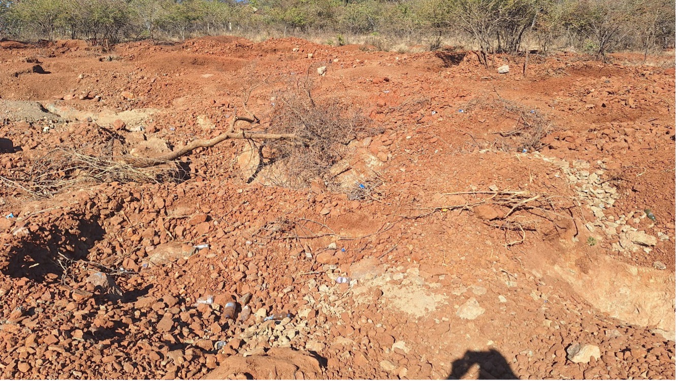
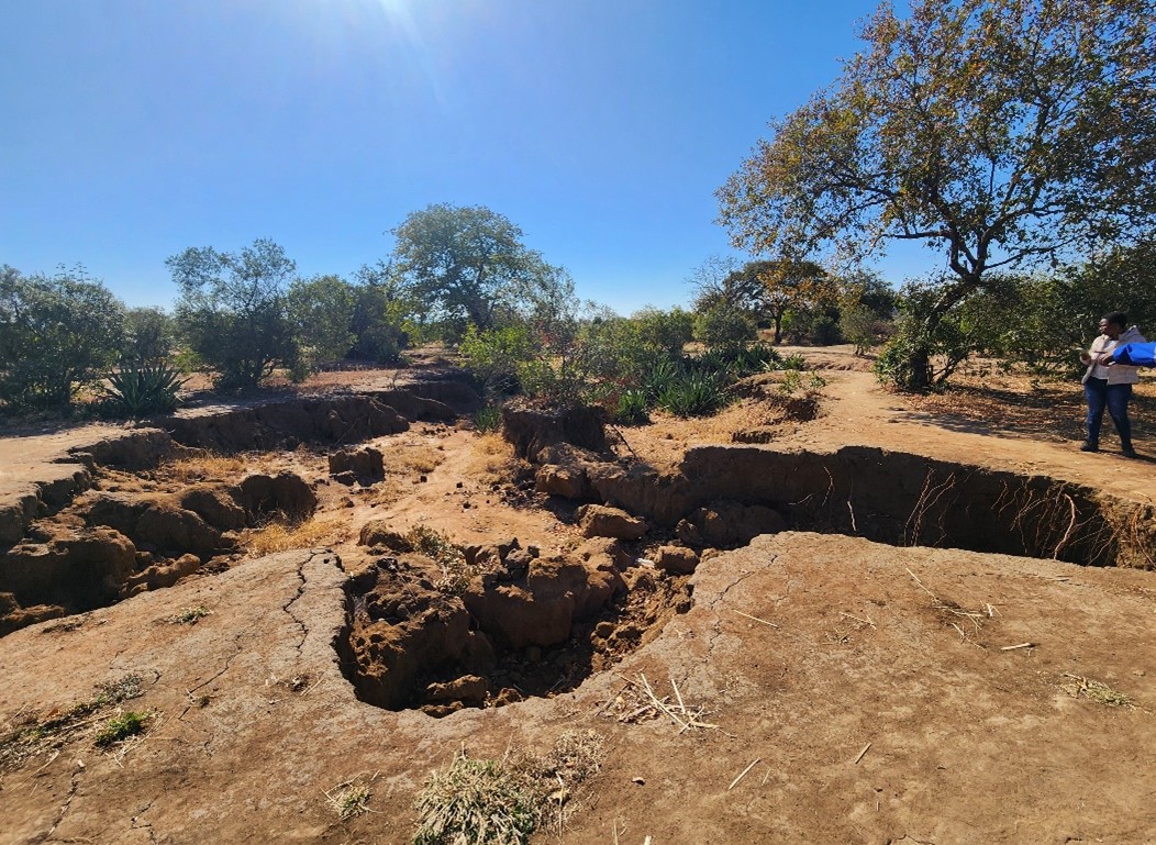
Formerly grazing land, this field in Gwanda is no longer able to support livestock. Photo courtesy of MCC Zimbabwe, 2025
Communities guiding solutions through collaborative mapping
An essential aspect of the research led by Kirit and Auther involved engaging communities in Gwanda in sharing their own insights to inform adaptation solutions. Through a collaborative effort, community members, including farmers, elders, and youth, identified areas of interest on large maps of their villages and surrounding areas. They marked important locations such as erosion sites, sacred sites, water sources, and family homes, providing vital guidance for project research and activities.
Similarly, during visits to the Mwenezi and Binga districts with Natalia, community elders shared the locations of sacred sites nestled within forests and wetlands with the research team. In line with LINCZ's commitment to cultural sensitivity, the team is dedicated to upholding cultural heritage protocols and maintaining the confidentiality of these coordinates while also ensuring the protection of these sacred places during project activities.
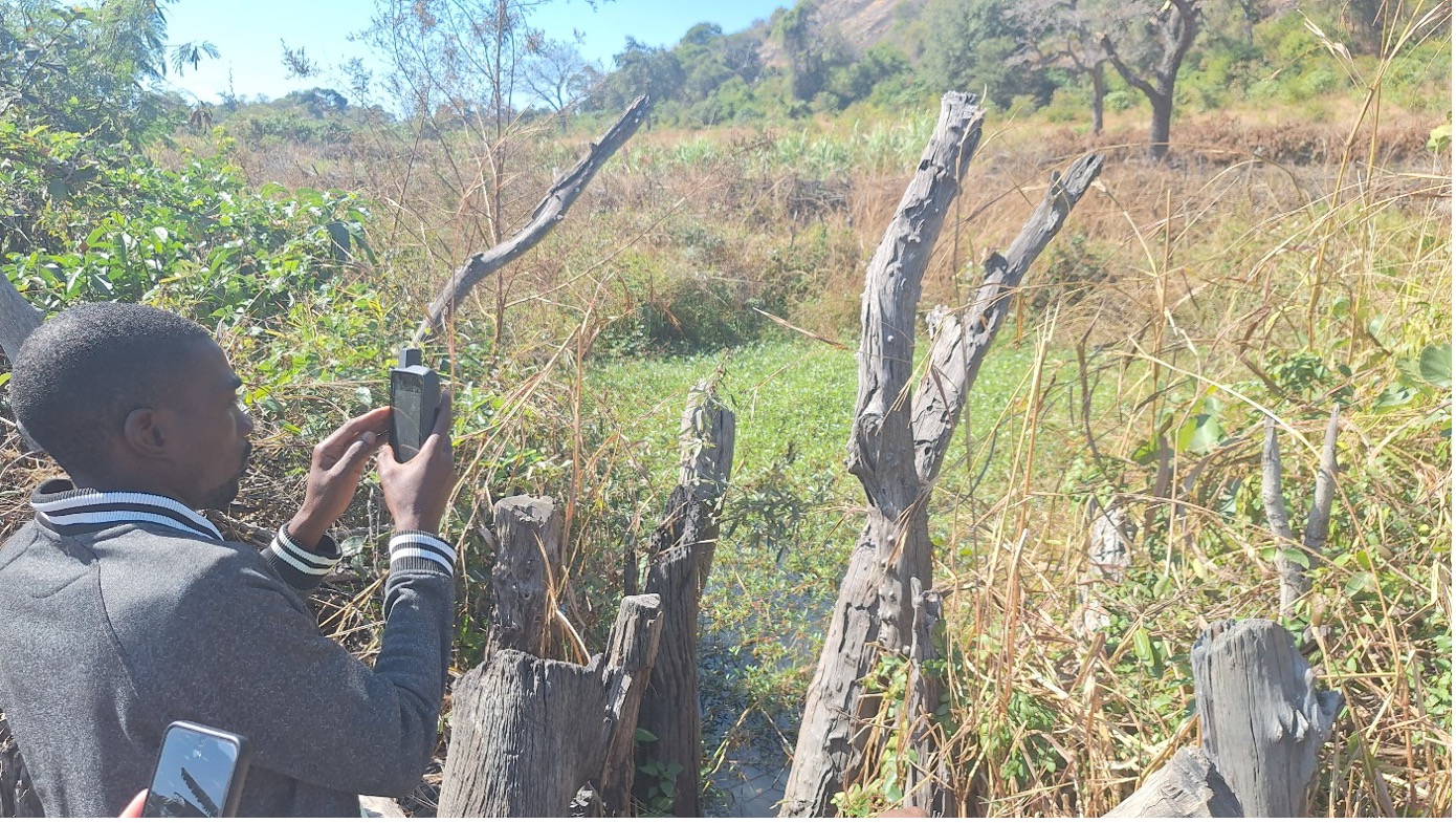
Score Against Poverty Community Biodiversity Lead, Ashton Mahachi, records a GPS point in the Chinyevenyeve wetland that will be protected and preserved under the LINCZ project in Mwenezi. Photo courtesy of MCC Zimbabwe, 2025.
Building on research—what's next?
Natalia's research visit highlighted the significance of community engagement and the importance of conflict and cultural sensitivity. MCC Zimbabwe is dedicated to translating these insights into practical, community-driven action. The LINCZ team looks forward to:
- Training and certifying MCC Zimbabwe staff in GPS and drone usage.
- Monitoring wetlands, gullies, and restoration sites in real-time with GIS.
- Launching community story maps—interactive online platforms that share local climate stories.
- Facilitating policy dialogues that integrate scientific data with community voices and perspectives.
- Strengthening safeguards to protect cultural and ethical integrity.
Final word
While maps alone do not change the world, the collaboration between communities and scientists, with the use of maps, fosters meaningful transformation. By integrating local knowledge with technology, we can leverage powerful tools to promote justice, resilience, and sustainability. The LINCZ project is proud to stand with Zimbabwean communities, committed to co-creating solutions that address environmental challenges and empower local voices. Together, we are not just mapping the future; we are building a sustainable one.
About the authors
Bulisani Mlotshwa is the Learning & Research Hub Coordinator and Ntuthuko Ngwenya is the Climate Change Adaptation and Technical Officer for Mennonite Central Committee (MCC) Zimbabwe. MCC Zimbabwe is supporting communities in Binga, Gwanda, and Mwenezi districts in the implementation of climate adaptation strategies to address challenges such as increases in drought frequency, loss of biodiversity, and food insecurity through the LINCZ project. LINCZ programming is made possible through the support of Global Affairs Canada and through partnerships with three local organizations; Kulima Mbobumi Training Centre, Score Against Poverty, Brethren in Christ Compassionate and Development Services, and three research collaborators; Canadian Mennonite University, National University of Science and Technology, and Global Biodiversity Information Facility Zimbabwe.
 Print This Blog Post